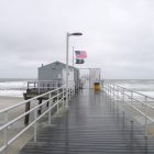
Watch out for flooding on Absecon island and offshore, particularly around high tides Thursday evening and through Friday as the wind strengthens and could bring waves of five to nine feet onto the shore, the National Weather Service said on Thursday.
A blocked pattern of strong easterly surface winds is causing a storm surge raising waves by two feet, according to the NWS alert. Those winds are expected to strengthen during Thursday and the storm surge could reach up to two and a half feet, the Service said.
“Easterly winds will whip waves of five to nine feet onto the shore as well,” according to the warning, which said that tidal flooding on Thursday night is expected to be deeper than the morning’s flooding.
You can read more here and here are some extracts from the report:
AT LEAST MINOR TIDAL INUNDATION FLOODING IS
ANTICIPATED WITH THE FRIDAY MORNING HIGH TIDE CYCLE, AND
POSSIBLY AGAIN FRIDAY EVENING.
A BLOCKED PATTERN OF STRONG EASTERLY SURFACE WINDS WILL CONTINUE INTO
AT LEAST FRIDAY MORNING. THIS HAS CAUSED STORM SURGES THIS MORNING
OF 2 FEET. THAT SURGE MAY INCREASE TO 2.5 FEET TONIGHT ALONG THE
SOUTHERN NEW JERSEY AND DELAWARE ATLANTIC COASTS AS THE EASTERLY
WIND STRENGTHENS 5 TO 10 MPH STRONGER THAN WHAT OCCURRED THIS MORNING.
WINDS SHOULD DIMINISH FRIDAY.
TIDAL INUNDATION FLOODING WILL OCCUR AGAIN
TONIGHT AND BE DEEPER THAN WHAT OCCURRED THIS MORNING. IN FACT
MODERATE COASTAL FLOODING IS POSSIBLE WITH THIS EVENINGS HIGH
TIDE CYCLE. EASTERLY WINDS WILL WHIP WAVES OF 5 TO 9 FEET ONTO
THE SHORE AS WELL.
